-40%
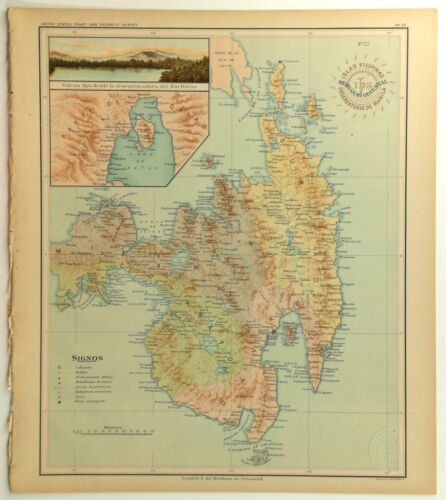
1899 Official US Navy Map Philippine Islands Isla Mindanao Oriental Samal Davao
$ 66
- Description
- Size Guide
Description
1899 Official US Navy Map Philippine Islands Isla Mindanao Oriental Samal Davao1899 Official US Navy Map Philippine Islands Isla Mindanao Oriental Samal Davao
This authentic 1899 color lithograph is from a collection of Philippine Islands area maps titled Atlas De Filipinas by P. Jose Algue, the Director of the Jesuit Manila Observatory, and Henry Pritchet of the Treasury Department United States Coast & Geodetic Survey. This is Map #27, Mindanao Oriental, Isla Filipinas, Observatorio De Manila, IHS (emblem of the Jesuits). This map was owned by the United States Department of the Navy as shown by the official perforated seal stamp. We have left the edge untrimmed for proof of provenance origin. Size is 13 x 14.5 inches. This will be shipped in a Priority Mail box with the map slightly curved. Used condition. See images.
inventory# D5


